
The process to develop a plan for Highland Village Green has involved several technical studies, documents and example images that can be viewed and downloaded below.
March 2017
March 2017
March 2017
Revised Landscape Concept with Existing Trees
March 2017
January 2017
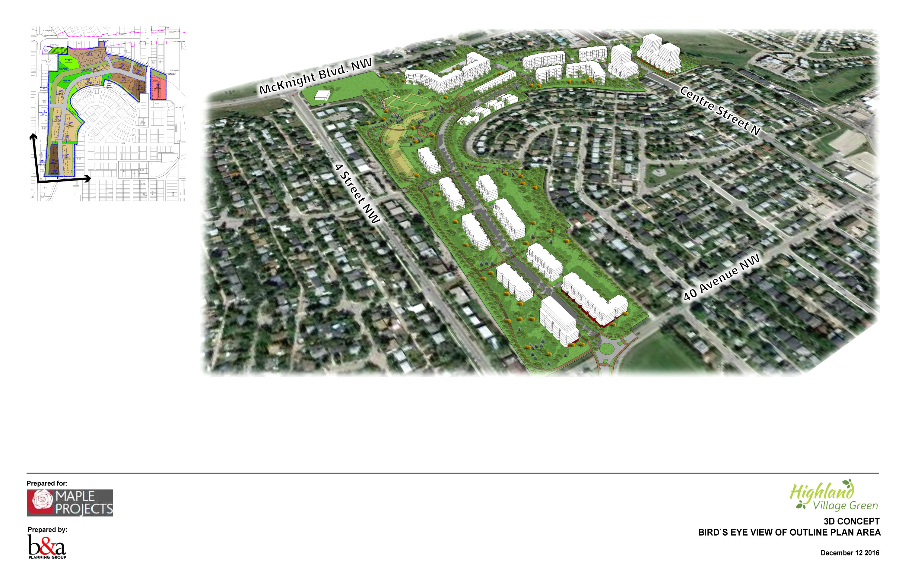
December 2016
January 2017
January 2017
January 2017
January 2017
December 2016
3D Concept of Outline Plan Area
As of December 13, 2016
Highland Village Green Outline Plan and Land Use Redesignation
Amended May 2016.
The version from April 11, 2016.
This PDF shows the progression of the Outline Plan from the site, from the initial submission in August 2014 to the latest version (April 2016).
This PDF shows the progression of the Illustrated Plan for the site, from the initial submission in August 2014 to the latest version (April 2016).
Illustrative Plan with Transit-Oriented Development overlay
From April 12, 2016. Demonstrates the impact on Transit-Oriented Development of the approved Green Line Transit Station at 40 Avenue NW, and the proposed station at McKnight Boulevard.
Transit-Oriented Development range
An aerial photo that shows the Transit Station ranges for Transit-Oriented Development.
Cross-section at Centre Street
Showing proposed traffic flow, with four lanes of traffic.
Transportation Impact Assessment report and update:
TIA Update (February 29, 2016)
Recent comments